|
| *****SWAAG_ID***** | 769 |
| Date Entered | 11/12/2013 |
| Updated on | 11/12/2013 |
| Recorded by | Tim Laurie |
| Category | Geological Record |
| Record Type | Geological HER |
| SWAAG Site | Downholme Moor |
| Site Access | Public Footpath |
| Record Date | 27/11/2013 |
| Location | Downholme Quarry |
| Civil Parish | Downholme |
| Brit. National Grid | SE 1130 9812 |
| Altitude | 227m |
| Geology | Fossiliferous Main Chert series strata overlying the Main Limestone. |
| Record Name | The Main Limestone and overlying fossiliferous chert strata exposed in Downholme Quarry |
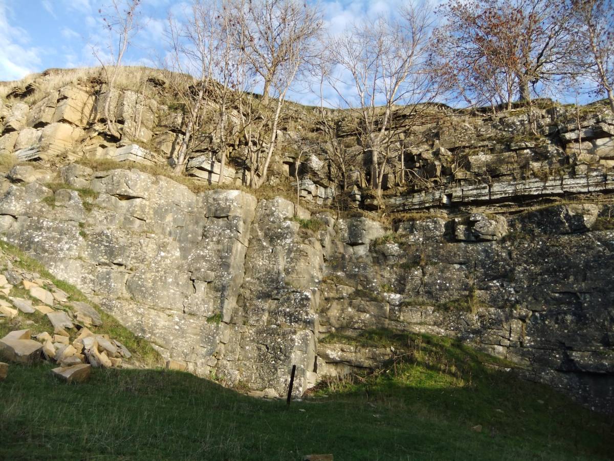
| Record Description | This record provides a photo record of the rarely so clearly exposed and seen thin bedded fossiliferous chert strata which directly overlies the massively bedded Main Limestone in the wall of Downholme Quarry.
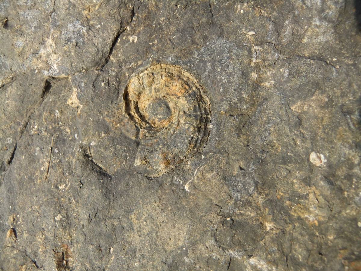
To my untrained eye the fossils seen include not only productid brachiopod shells but also very fine examples of the polyzoan Fenestella sp and sections through two examples of spirally structured shells which may be large gastropods or possibly goniatites. Reference: The British Museum. British Palaeozoic Fossils.
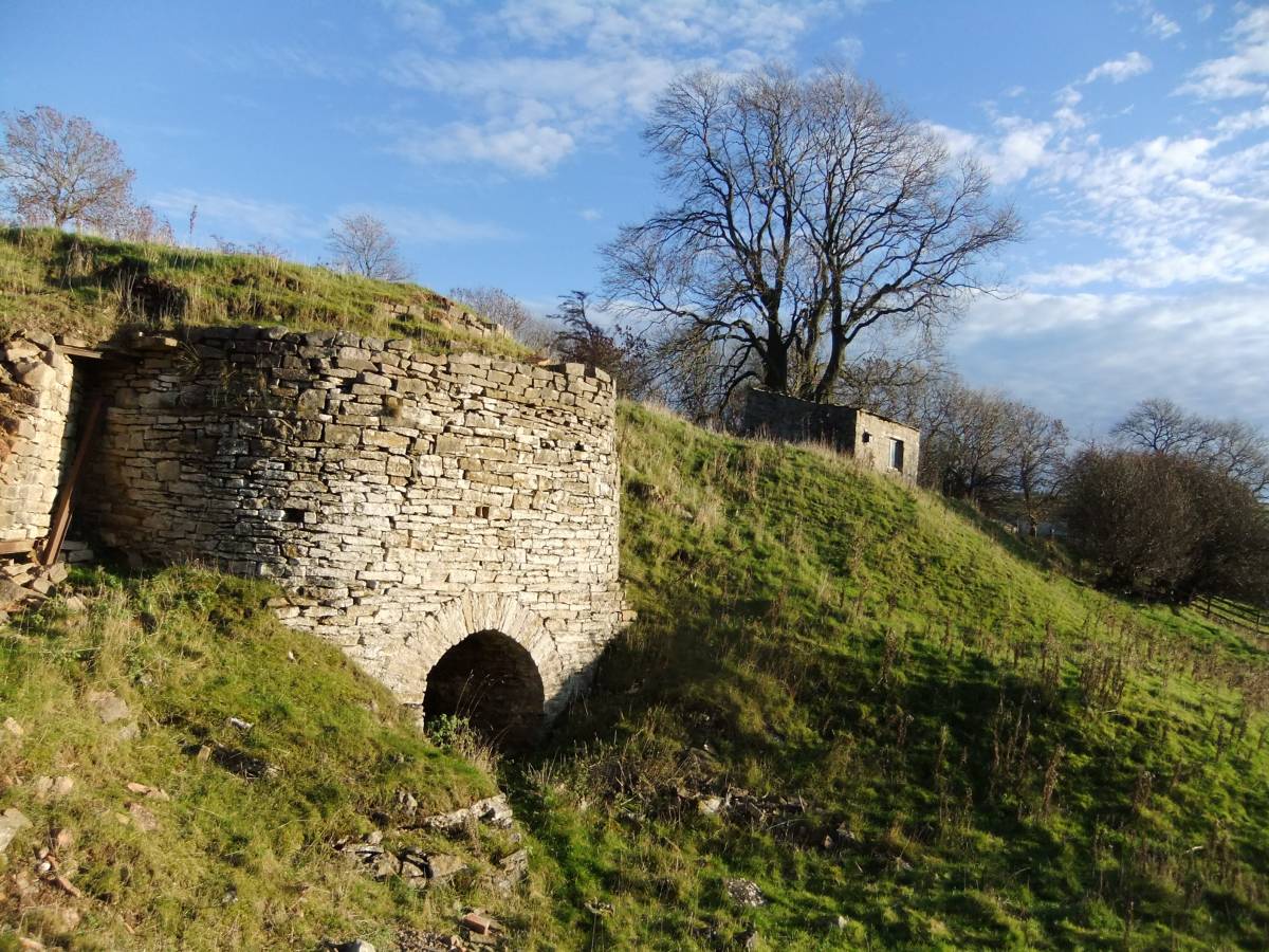
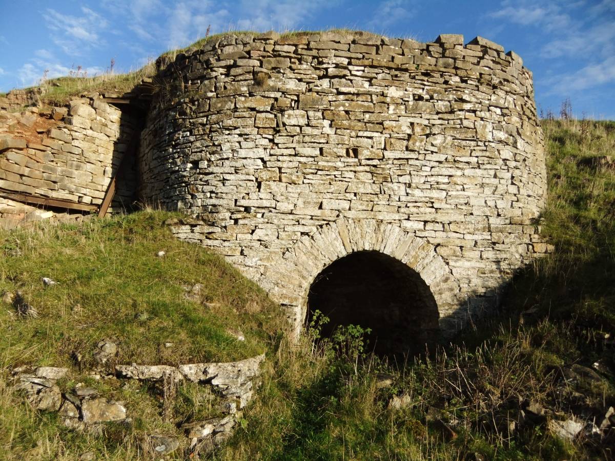
Below the quarry is a very fine limekiln.
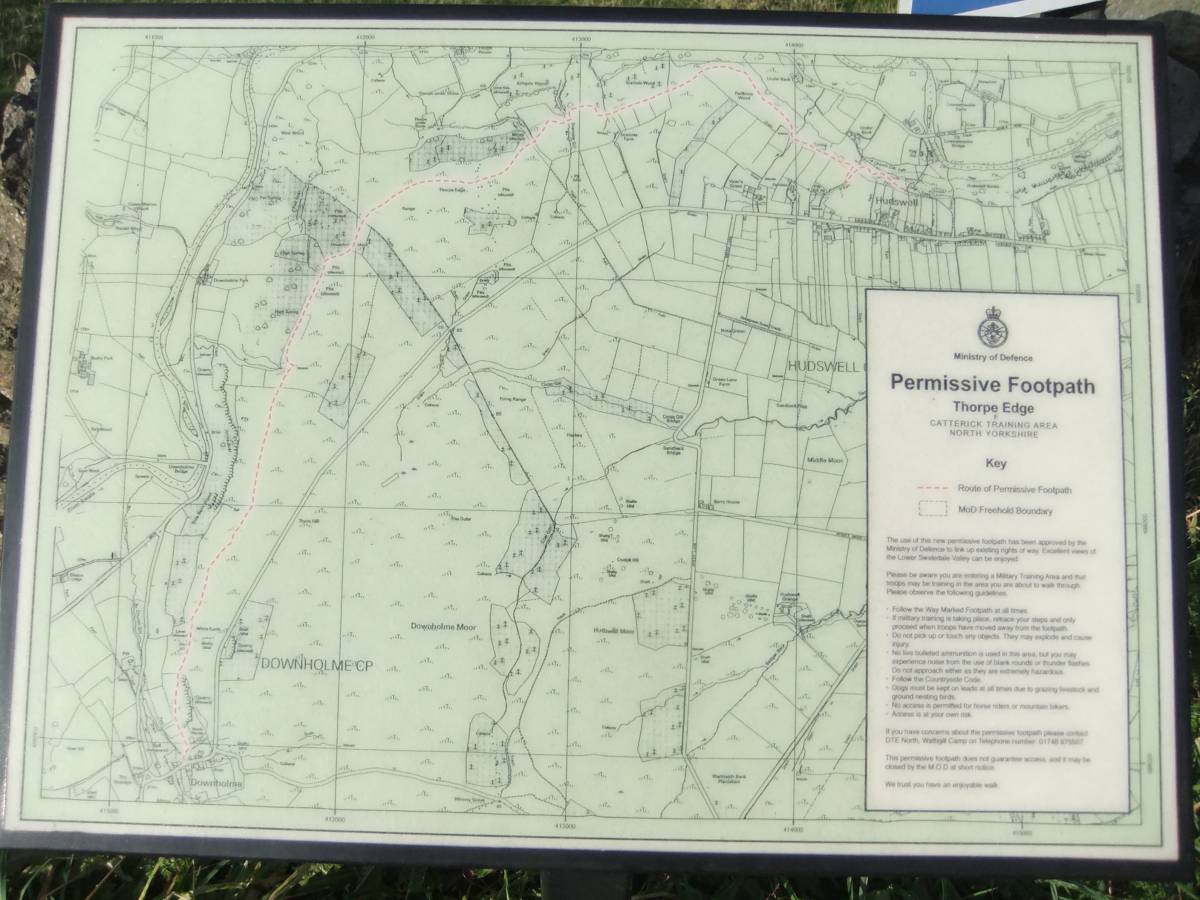
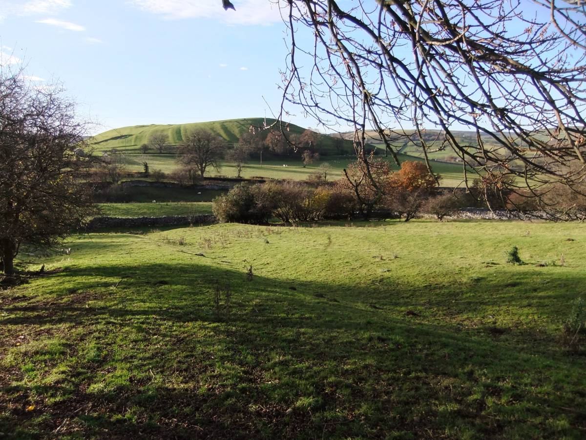
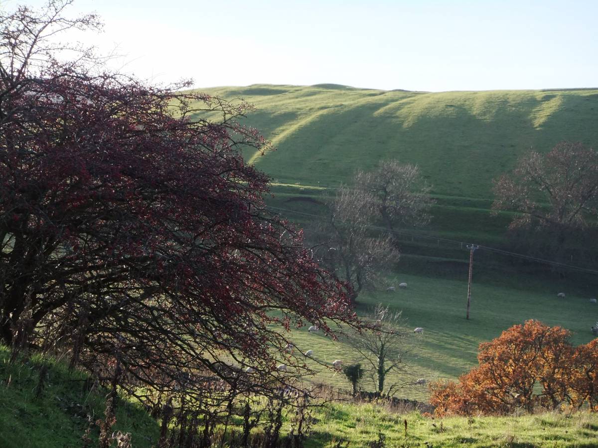
Large ash trees grow in the hedgerows around the quarry and a walk on the MOD Downholme Permissive Footpath which passes the entrance to this quarry is worth while to see the views from high of the discreetly located Downholme Church and across to the medieval lynchets and iron age defensive earthworks on the summit of How Hill, Downholme. See photofile. |
| Dimensions | See photographs. |
| Additional Notes | This quarry is on MOD Land but can be seen from the Downholme Permissive Footpath which traverses the western edge of the MOD Range. Access is at your own risk. Do not approach or climb the exposed rock face and observe the access and safety rules laid down at the entrance to the quarry and in the Permissive Footpath Leaflet.
This quarry will be visited at the beginning of a walk for SWAAG Members and their guests during a programme of walks planned to take place in the New Year. |
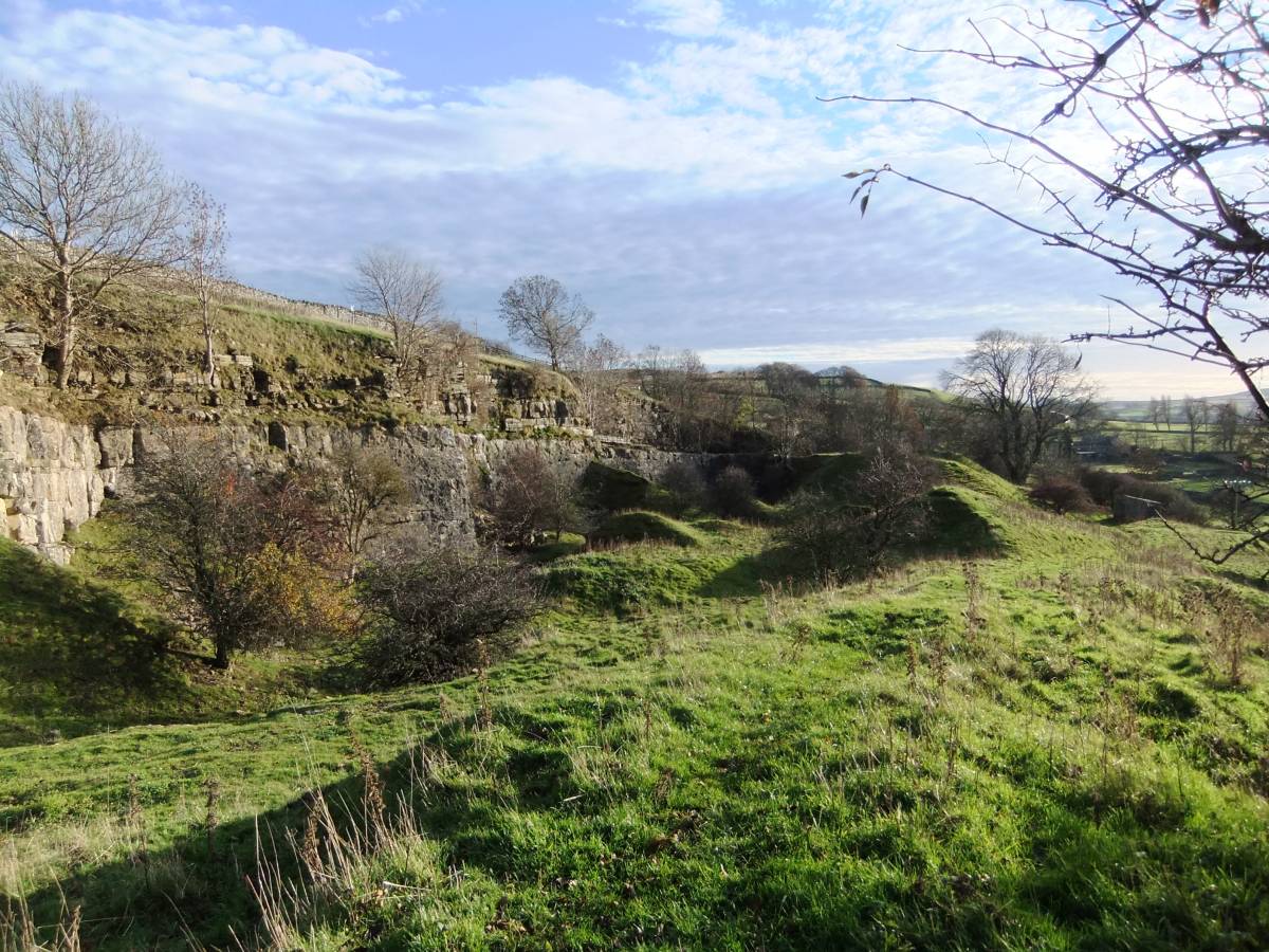
| Image 1 ID | 4866 Click image to enlarge |
| Image 1 Description | The Downholme Quarry from the MOD Permissive footpath to Thorpe Edge. | 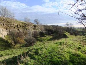 |
| Image 2 ID | 4867 Click image to enlarge |
| Image 2 Description | The face of the quarry with thin bedded chert strata above the Main Limestone. | 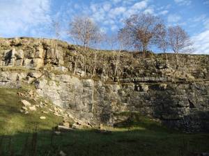 |
| Image 3 ID | 4868 Click image to enlarge |
| Image 3 Description | | 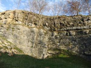 |
| Image 4 ID | 4871 Click image to enlarge |
| Image 4 Description | Surface of limestone with fossils. | 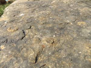 |
| Image 5 ID | 4869 Click image to enlarge |
| Image 5 Description | Possible Goniatite. A rare zonal fossil of the Namurian.Detail | 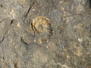 |
| Image 6 ID | 4870 Click image to enlarge |
| Image 6 Description | Possible Goniatite. A rare zonal fossil of the Namurian. Detail. | 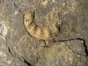 |
| Image 7 ID | 4874 Click image to enlarge |
| Image 7 Description | Productid brachiopod shells and the bryozoan fenestella. | 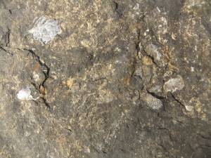 |
| Image 8 ID | 4876 Click image to enlarge |
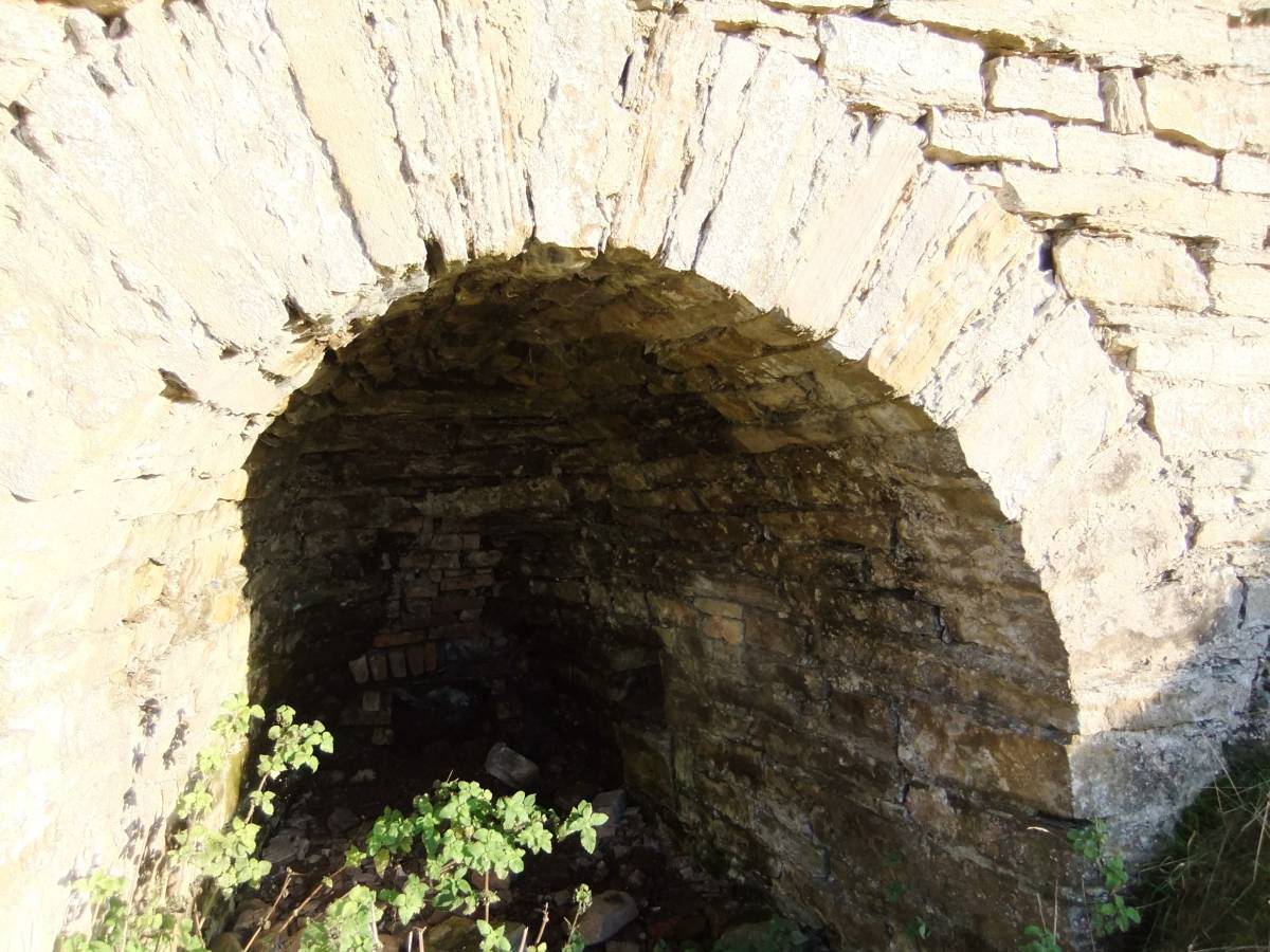
| Image 8 Description | The lime kiln |  |
| Image 9 ID | 4877 Click image to enlarge |
| Image 9 Description | | 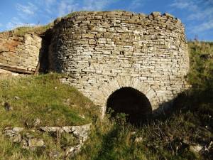 |
| Image 10 ID | 4878 Click image to enlarge |
| Image 10 Description | | 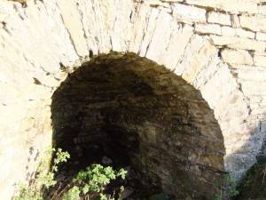 |
| Image 11 ID | 4879 Click image to enlarge |
| Image 11 Description | | 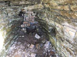 |
| Image 12 ID | 4880 Click image to enlarge |
| Image 12 Description | |  |
| Image 13 ID | 4886 Click image to enlarge |
| Image 13 Description | The Permissive Footpath Signboard at Downholme Village. | 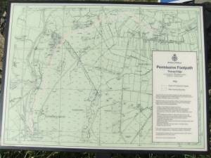 |
| Image 14 ID | 4885 Click image to enlarge |
| Image 14 Description | How Hill, Downholme from the Quarry. | 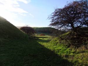 |
| Image 15 ID | 4883 Click image to enlarge |
| Image 15 Description | How Hill, Downholme from the Quarry. | 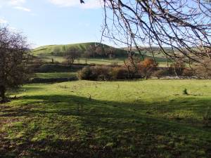 |
| Image 16 ID | 4884 Click image to enlarge |
| Image 16 Description | Earthworks on How Hill, early cultivation overlies an Iron Age defended settlement. |  |